Maintaining more than 1,400 miles of roadway across Atlanta requires more than responding to potholes. It requires knowing where infrastructure is deteriorating, understanding which improvements should come first and making informed decisions about where transportation dollars can have the greatest impact. The Atlanta Department of Transportation (ATLDOT) has partnered with Cyvl to do exactly that.
Cyvl is an AI-powered intelligence platform that uses LiDAR sensors, advanced imagery, and artificial intelligence (AI) to collect detailed information about the condition of transportation infrastructure. The technology is helping teams prioritize maintenance and make data-backed infrastructure investments.
Traditionally, assessing a large roadway network can require extensive manual surveys and months of work. Cyvl’s technology allows ATLDOT to scan and analyze the City’s 1,450-mile road network in days.
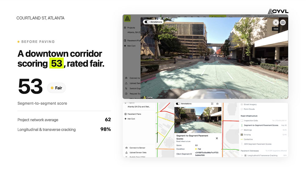
As vehicles equipped with Cyvl’s technology travel Atlanta’s streets, information about the roadway is captured. AI then analyzes that information to identify pavement conditions. The result is objective data showing what infrastructure exists, where it is located, and what condition it is in.
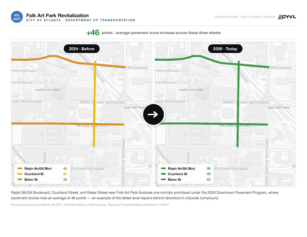
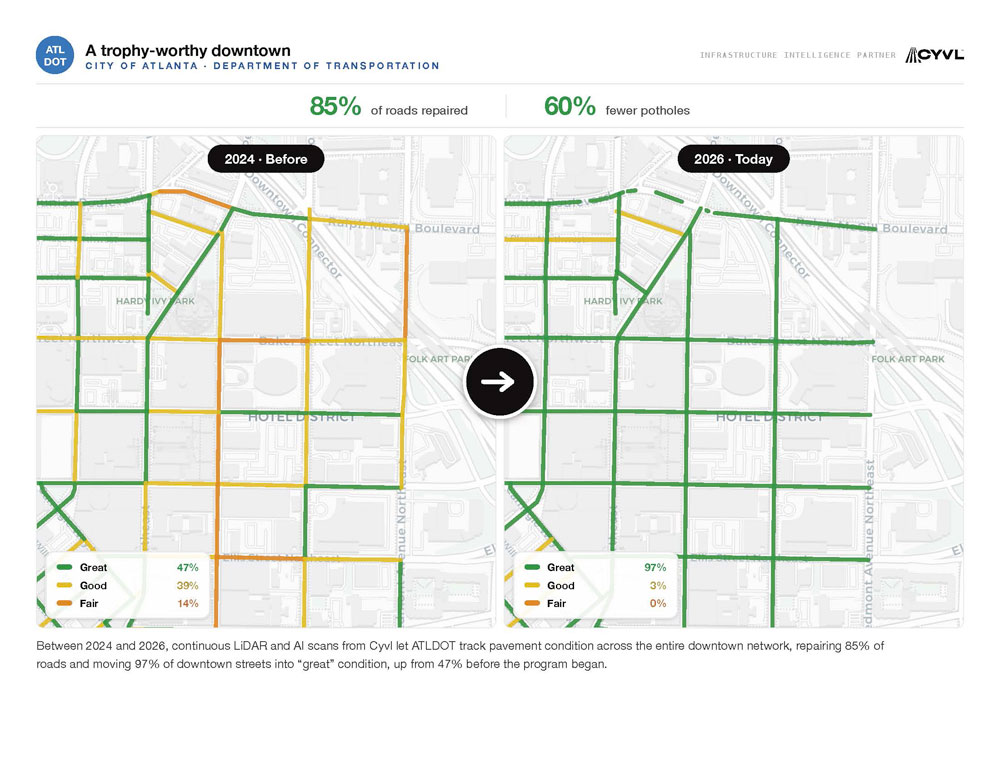
Better Pavement Across Downtown Atlanta
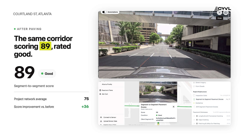
Taking the Approach Citywide
Building on the results of the Downtown Pavement Program, Atlanta has expanded its partnership with Cyvl citywide. The expanded program covers roadways, sidewalks, curb ramps, and street signs.
“The Downtown Pavement Program results show what data-driven infrastructure management can do,” ATLDOT Commissioner Solomon Caviness said. “By using reliable, continuously updated information, we reduced potholes, improved pavement conditions, and made smarter investments. Expanding this approach citywide will help us stretch every infrastructure dollar, prioritize where the need is the greatest, and stay ahead of issues in every neighborhood.”